SATELLITE GEOSCIENCES LAB
DEPT. EARTH SYSTEM SCIENCES YONSEI UNIVERSITY
연세대학교 위성지구과학 연구실 홈페이지에 방문하신 것을 환영합니다
Hahn Chul Jung
This is the webpage of the Satellite Geosciences Research Group at the Department of Earth System Sciences, Yonsei University. The group is led by Hahn Chul Jung, and the research that we do focuses on radar remote sensing, land information system, natural disaster monitoring, and the study of large-schale hydrology.
The lab’s door is always open to PhD, MSc, and undergraduate students looking for research topics. Please feel free to visit me to learn more about possible research topics and programs.
The lab’s door is always open to PhD, MSc, and undergraduate students looking for research topics. Please feel free to visit me to learn more about possible research topics and programs.
Education
Ph.D. in Earth Sciences
Dissertation-Wetland hydrodynamics using interferometric synthetic aperture radar, remote sensing, and modeling
M.Sc. in Earth System Sciences
Thesis-Observation of the ground subsidence in Gaeun area using permanent scatterer interferometric synthetic aperture radar
B.Sc. in Earth System Sciences
Work Experience
Associate Professor
- Satellite Geosciences, Satellite Hydrology
Joint Associate Professor
- Coastal Remote Sensing
Senior Research Scientist
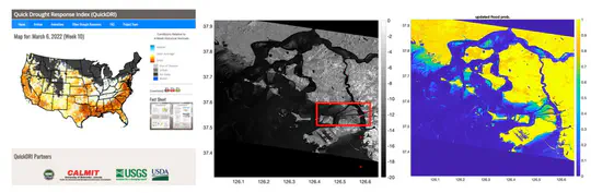
- Spatio-temporal variability of coastal wetlands using Synthetic Aperture Radar
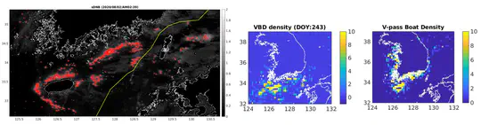
- Development of satellite-based system on monitoring and predicting ship distribution in the contiguous zone
Lead & Chief Research Scientist
- A West Africa LDAS for forecasting extreme hydrological Events
- Water balance and resource studies using satellite observations
- LIS (Land Information System) modeling
- Radar flood mapping
Postdoctoral & Research Associate
- Radar application on ecosystem and hazard
- 2D floodplain hydrodynamic LISFLOOD model
Research
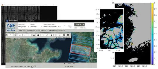
Spatiotemporal variability of coastal wetlands using imaging radar data
radar remote sensing, geospatial information, tidal flat
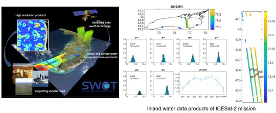
Advancing satellite altimeter analysis technology and utilization
altimeter remote sensing, algorithm development
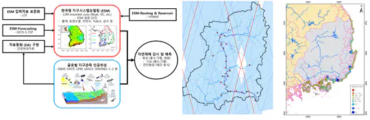
Convergence of multi-satellite data and earth system modeling for natural hazard monitoring of land and coastal environments
land information sytem, modeling, water resources
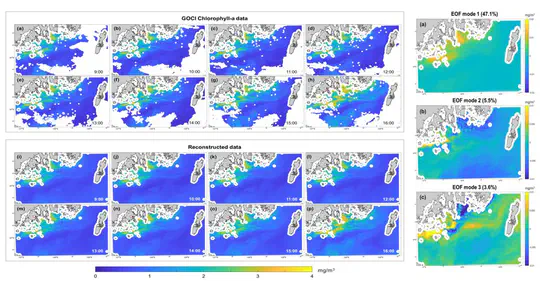
Development of space-time missing data restoration algorithm from Geostationary Ocean Color Imager
optical remote sensing, algorithm development
Earth system sciences satellite planing and utilizatoin research
geosciences, remote sensing
Satellite big data and geospatial data technology developments
geospatial information, remote sensing
Contact
- hahnchul.jung@yonsei.ac.kr
- +82-2-2123-2677
- 50 Yonsei-ro, Seodaemun-gu, Seoul 03722
- 645 Science Hall, College of Science, Yonsei University